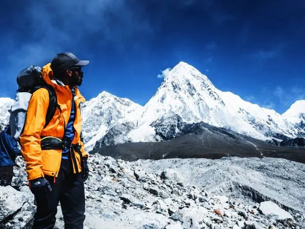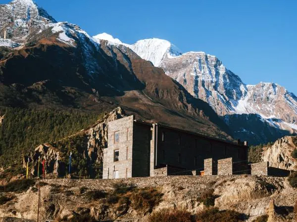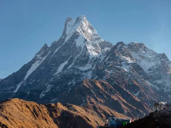

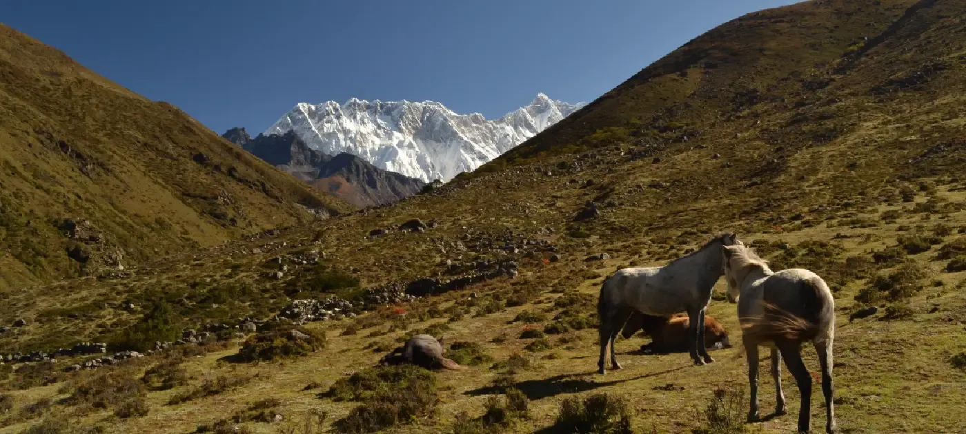
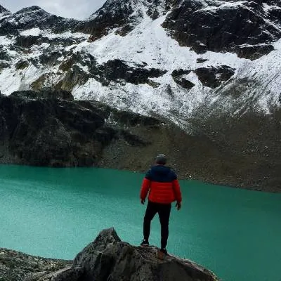
At first glance, the Everest Base Camp trek map looks straightforward. The classic route begins in Lukla, follows the Dudh Koshi Valley through a series of Sherpa villages, reaches Base Camp at 5,364 meters (17,598 feet), and then returns to Lukla along the same trail.
However, the map represents much more than a walking route. It shows how the trek gradually gains altitude, where acclimatization days are required, and how the landscape changes from lush forests and suspension bridges to rocky glacial terrain beneath the world's highest mountain.
The classic Everest Base Camp route starts with a flight to Lukla, the gateway to Nepal's Khumbu region. From there, the trail passes through Phakding, Namche Bazaar, Tengboche, Dingboche, Lobuche, and Gorak Shep before reaching Everest Base Camp. Each village plays an important role in helping trekkers acclimatize, rest, and prepare for the next stage of the journey.
Understanding the route before you begin makes it easier to plan your itinerary, estimate daily walking distances, prepare for altitude changes, and appreciate the remarkable landscapes that unfold along the way.
Everest Base Camp Trek Route at a Glance
Before explaining each section of the trail, give readers a quick overview of the entire route.
| Route Section | Distance | Walking Time | Elevation |
|---|---|---|---|
| Lukla to Phakding | 8 km | 3–4 hours | 2,610 m |
| Phakding to Namche Bazaar | 10–11 km | 6–7 hours | 3,440 m |
| Namche Bazaar to Tengboche | 10 km | 5–6 hours | 3,860 m |
| Tengboche to Dingboche | 11 km | 5–6 hours | 4,410 m |
| Dingboche to Lobuche | 8 km | 5 hours | 4,910 m |
| Lobuche to Gorak Shep | 4.5 km | 3 hours | 5,164 m |
| Gorak Shep to Everest Base Camp | 3.5 km | 2–3 hours | 5,364 m |
Quick Facts About the Everest Base Camp Trek Route
Readers often want the key facts before diving into the details.
- Starting Point: Lukla (2,860 m)
- Ending Point: Everest Base Camp (5,364 m)
- Highest Elevation: Kala Patthar (5,545 m)
- Total Trekking Distance: Approximately 130 km (round trip)
- Duration: 12–14 trekking days
- Region: Khumbu, Solukhumbu District
- National Park: Sagarmatha National Park
- Maximum Daily Walking Time: 7–8 hours
- Accommodation: Mountain teahouses
- Trail Type: Out-and-back (most trekkers return via the same route)
Why the Everest Base Camp Route Follows This Trail?
Many first-time EBC trekkers wonder why everyone follows the same path. The answer lies in the geography of the Khumbu region. The trail follows the Dudh Koshi River valley because it provides the safest and most practical route through the mountains. Villages, suspension bridges, teahouses, and rest stops have developed along this valley over many decades, making it the most reliable path to Everest Base Camp.
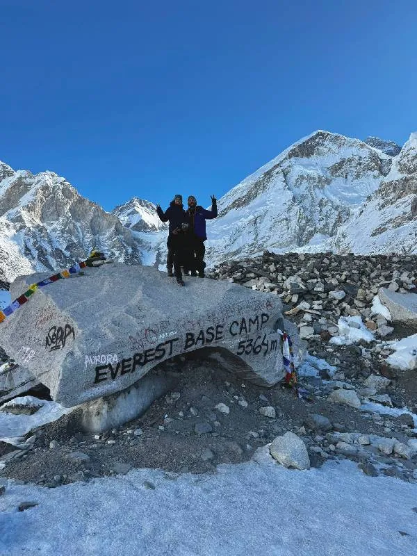
Although there are alternative trekking routes, the classic Lukla–Everest Base Camp trail remains the most popular because it offers gradual altitude gain, excellent accommodation, and stunning Himalayan scenery while reducing unnecessary risks.
Major Villages Along the Everest Base Camp Trek
The villages along the Everest Base Camp route are more than simple overnight stops. Each settlement plays an important role in the trekking journey, offering accommodation, cultural experiences, acclimatization opportunities, and a glimpse into Sherpa life.
| Village | Elevation |
|---|---|
| Lukla | 2,860 m |
| Phakding | 2,610 m |
| Namche Bazaar | 3,440 m |
| Tengboche | 3,860 m |
| Dingboche | 4,410 m |
| Lobuche | 4,910 m |
| Gorak Shep | 5,164 m |
| Everest Base Camp | 5,364 m |
Everest Base Camp Trek Route Map
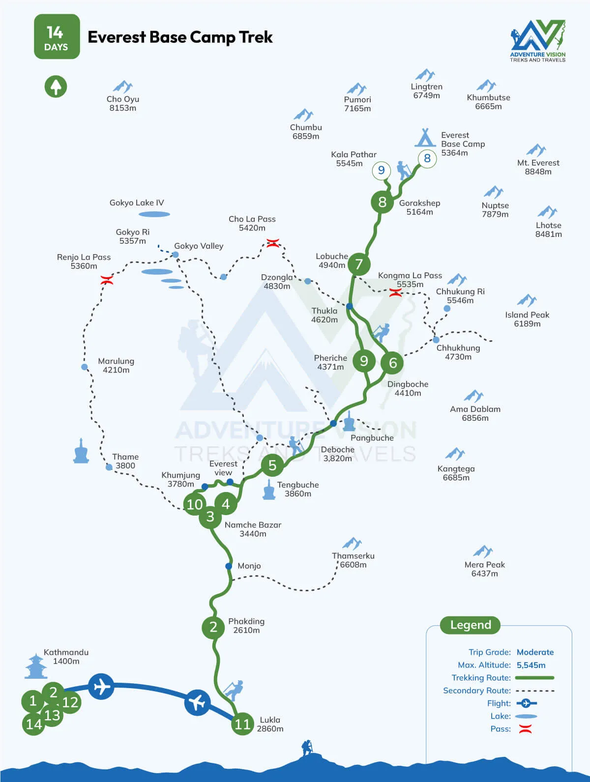
Starting from Lukla: The Real Beginning of the Route
Starting from Lukla is the first step before making your Everest base camp trek journey real.
Before that, Everest base camp was just an idea, photo or a dream. But as soon as you land in Tenzing Hillary airport, porters, the teahouses, the mountain air and the prayer flags make everything feel serious.
From the airport, the trail does not instantly become truly difficult. The first walking section towards Phakding feels like a warm up. The trail goes through small colonies, hanging bridges, and forested areas. On the map, Lukla Phakding may look like a small section, but it helps trekkers slowly enter the flow of walking in the Himalayas.
Phakding to Namche Bazaar: Where the Trek Starts Testing You
The route from Phakding to Namche bazaar is one of the first segments where many trekkers understand that the Everest base camp is not only about stamina. It’s also about patience.
The trail follows the Dudh Koshi river and passes through villages like Monjo before entering the Sagarmatha national park area. permits are checked. and after that, the trail becomes more serious with suspension bridges and long uphill climb toward Namche bazaar.
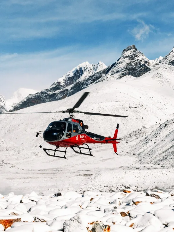
On the map, Namche bazaar looks like just another stop. But in real trekking experience, Namche feels like a small victory. After the climb, seeing the colorful houses built on the hillside gives a huge feeling of relief. It is also the main place where trekkers rest, eat better food, charge devices, buy small supplies, and prepare themselves for higher altitude.
Namche Bazaar Acclimatization Day
Namche bazaar is an important acclimatization stop. Trekkers usually send an extra day here to help their bodies adjust before going higher. This rest day is not only for sleeping. Many trekkers take a short hike to a higher viewpoint and then return to Namche.
This helps the body get used to the altitude in a safer way. It also gives trekkers time to explore the village and enjoy the views. From here, the altitude gain becomes more serious, so proper rest is very important.
Namche to Tengboche: Scenic Trail and Mountain Views
The trail from Namche to Tengboche is one of the most beautiful journeys of trail. The park offers hills, valleys, rivers, and snow-covered peaks. Some parts are easy, but the final climb to Tengboche can feel hard.
Tengboche is famous for its monastery and peaceful mountain setting. It is one of the most memorable stops on the EBC trek route. The village feels calm, open and spiritual. When the sky is clear, the mountain views from this area are stunning. From, this part of village the trek changes slowly. The lower villages start to fade behind and the trail begins to feel more remote.
Tengboche to Dingboche: Moving Toward Higher Altitude
From Tengboche, the trail continues towards Dingboche. The route passes through deboche and pangboche before reaching more open land. The trees become fewer, the air becomes colder, and the landscape starts looking dry and wide.
Dingboche is another main acclimatization point on the Everest base camp trek map. Trekkers usually spend extra day here before going toward lobuche. This stop is important because the body needs more time to adjust at this height.
By the time you reach Dingboche, the trek feels different. The green hills are mostly behind, and the Himalayan landscape becomes stronger.
Dingboche to Lobuche: The Trail Becomes Tougher
The walk from Dingboche to lobuche is not very sharp, but the altitude makes it harder. Trekkers usually walk slower here. Even simple uphill sections can feel heavy because the air is thinner.
The route passes through open valleys, rocky trails, and memorial areas. This part of the Everest Base Camp trekking route feels quiet and powerful. The mountains look closer, and the journey starts to feel more serious. Lobuche is a small but important overnight stop. It prepares trekkers for the final route toward Gorak Shep and Everest Base Camp.
Lobuche to Gorak Shep: Near the Final Point
Gorak shep is the last accommodations place Everest base camp. The route from lobuche to Gorak shep can feel tiring because of the rocky trail and high altitude.
The village feels remote and cold. There are basic lodges, open land, and a strong feeling that base camp is finally close. Most trekkers rest here before walking toward Everest base camp. This i route map. The destination that once looked far away on the map is now only a few hours away.
Gorak Shep to Everest Base Camp
The trail from Gorak shep to Everest base camp is rocky and uneven. It moves near the Khumbu glacier, so trekkers need to walk carefully. This part of the journey is not about rushing. It is about staying steady and reaching safely.
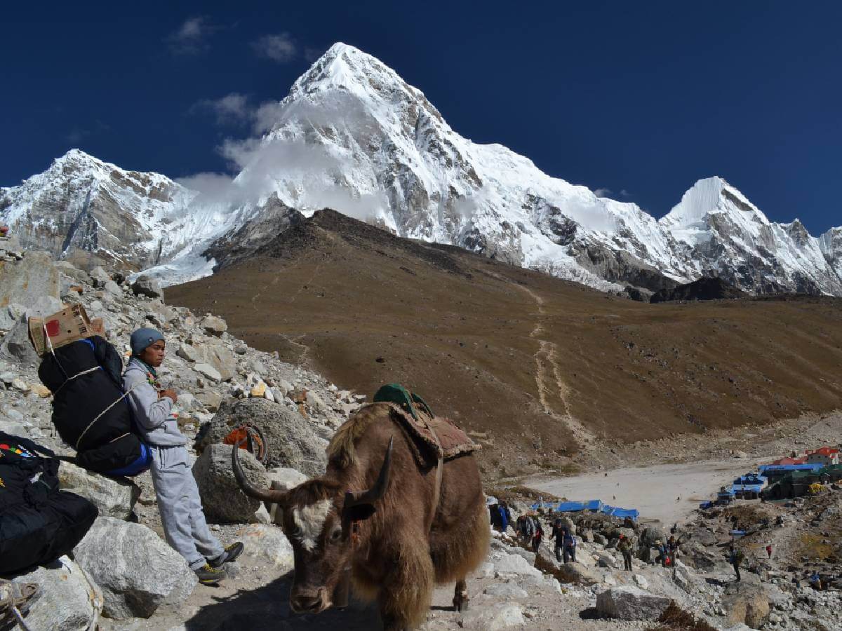
Everest Base Camp is a simple but powerful place. There may be prayer flags, stones, glacier views, and expedition tents during climbing season. The place itself is not fancy, but the feeling of reaching there is unforgettable. For many trekkers, Everest Base Camp is not just a destination. It is proof of patience, effort, and strong will.
Kala Patthar: The Best Viewpoint of Mount Everest
Kala Patthar is often the best viewpoint if the Everest base camp is the main goal. Many trekkers hike to kala Patthar from Gorakshep to see mount Everest more clearly.
The Kala Patthar hike is short compared to the whole trek, but it is difficult because of the altitude. The climb is cold, steep, and slow. Still, the view from the top makes the effort worth it. For many people, Everest Base Camp gives the achievement, but Kala Patthar gives the view they remember for life.
Suspension Bridges on the Everest Base Camp Route
One of the most memorable features of the Everest Base Camp trek is the series of suspension bridges spanning the Dudh Koshi River. Trekkers cross numerous bridges throughout the journey, including the famous Hillary Suspension Bridge near Namche Bazaar. These bridges connect remote Sherpa villages, carry supplies into the mountains, and have become iconic landmarks of the trek. While they may appear intimidating at first, they are strong, well-maintained, and safe to cross.
Rivers and Glaciers Along the Route
The trail closely follows the Dudh Koshi River during the lower sections of the trek. As you gain altitude, the landscape changes dramatically. Dense forests give way to alpine meadows, rocky valleys, and finally the rugged terrain surrounding the Khumbu Glacier. Near Gorak Shep and Everest Base Camp, trekkers walk alongside one of the world's highest glaciers, where the landscape is dominated by ice, moraines, and towering Himalayan peaks.
Is the Everest Base Camp Route Difficult to Follow?
The Everest Base Camp trail is considered one of the easiest high-altitude trekking routes to navigate in Nepal. The path is well-established and clearly marked, with frequent villages, teahouses, signboards, and fellow trekkers. During the main trekking seasons, it is rare to walk for long without encountering other hikers or local guides.
However, heavy snowfall, poor visibility, or trekking during the off-season can make navigation more challenging. Carrying an offline map or trekking with an experienced guide provides additional safety and confidence.
Alternative Routes to Everest Base Camp
While the classic Lukla route is the most popular, experienced trekkers sometimes choose alternative routes to extend their adventure.
Everest Base Camp via Gokyo Lakes
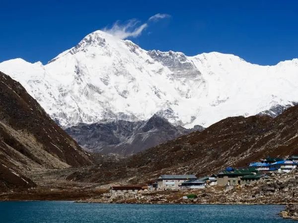
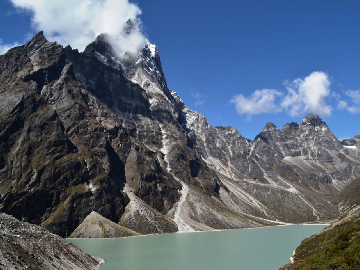
This scenic variation includes the stunning turquoise Gokyo Lakes and the challenging Cho La Pass before joining the classic Everest Base Camp trail.
Everest Three Passes Trek
Everest Three Pass trek is Considered one of Nepal's most demanding trekking routes, this circuit crosses Kongma La, Cho La, and Renjo La while including Everest Base Camp and Kala Patthar.
Jiri to Everest Base Camp
Before Lukla Airport was built, trekkers started from Jiri. This traditional route adds around a week to the journey and passes through lower Himalayan villages.
Offline Maps and Navigation
Although the trail is straightforward, downloading an offline map before arriving in the Everest region is highly recommended. Mobile networks become unreliable at higher elevations, making offline navigation a valuable backup.
Popular mapping apps include Maps.me, Organic Maps, and AllTrails. These apps allow trekkers to view the route, track their progress, and locate nearby villages without requiring an internet connection.
Elevation Profile of the Everest Base Camp Trek
One of the defining features of the Everest Base Camp trek is the gradual increase in altitude. Rather than climbing directly to Base Camp, the route includes two important acclimatization stops in Namche Bazaar and Dingboche. This steady ascent allows the body to adapt to lower oxygen levels and significantly reduces the risk of altitude sickness.
Elevation progression:
- Lukla – 2,860 m
- Phakding – 2,610 m
- Namche Bazaar – 3,440 m
- Tengboche – 3,860 m
- Dingboche – 4,410 m
- Lobuche – 4,910 m
- Gorak Shep – 5,164 m
- Everest Base Camp – 5,364 m
- Kala Patthar – 5,545 m
Seasonal Changes Along the Route
The Everest Base Camp trail changes dramatically throughout the year. Spring (March to May) brings blooming rhododendron forests, warmer temperatures, and busy trails. Autumn (September to November) offers the clearest mountain views and the most stable weather, making it the most popular trekking season. Winter transforms the route into a snowy landscape with fewer trekkers, while the summer monsoon creates lush greenery but can also bring rain, clouds, and occasional flight delays to Lukla.
Frequently Asked Questions About Everest Base Camp Trek Map and Route
Where does the Everest Base Camp Trek route start and end?
The classic Everest Base Camp Trek route starts from Lukla, a small mountain town in Nepal's Khumbu region, after a scenic flight from Kathmandu. From Lukla, trekkers follow the trail through Phakding, Namche Bazaar, Tengboche, Dingboche, Lobuche, and Gorak Shep before reaching Everest Base Camp. The trek usually ends by returning to Lukla through the same route.
How long is the Everest Base Camp Trek route?
The total Everest Base Camp Trek route covers approximately 130 km (80 miles) round trip, including the journey from Lukla to Everest Base Camp and the return walk. The actual distance can vary slightly depending on the itinerary, side hikes, and viewpoints such as Kala Patthar.
What is the highest point on the Everest Base Camp Trek route?
The highest point of the Everest Base Camp Trek is Kala Patthar at 5,545 meters (18,192 feet). Although Everest Base Camp itself sits at 5,364 meters (17,598 feet), many trekkers climb Kala Patthar because it offers one of the best panoramic views of Mount Everest and surrounding Himalayan peaks.
Is the Everest Base Camp Trek route difficult to follow?
The Everest Base Camp route is relatively easy to follow because it is a well-established trekking trail with villages, teahouses, signboards, and other trekkers along the way. However, weather conditions, snowfall, and poor visibility can make navigation more challenging, especially during winter or off-season trekking.
Can I complete the Everest Base Camp Trek without a guide?
Yes, experienced trekkers can complete the Everest Base Camp Trek independently because the main route is clearly marked and has frequent settlements. However, hiring a local guide can make the journey safer and easier by helping with navigation, altitude management, accommodation, communication, and emergencies.
What villages are included on the Everest Base Camp Trek route?
The major villages along the classic Everest Base Camp Trek route include:
- Lukla
- Phakding
- Monjo
- Namche Bazaar
- Tengboche
- Pangboche
- Dingboche
- Lobuche
- Gorak Shep
These villages serve as important stops for accommodation, meals, acclimatization, and rest.
Does the Everest Base Camp Trek follow the same route back?
Yes, most trekkers return from Everest Base Camp to Lukla by following the same trail. However, the return journey feels different because the altitude decreases, the walking becomes easier, and trekkers experience familiar landscapes from a new perspective.
Some extended treks return through alternative routes such as the Gokyo Lakes route or the Everest Three Passes route.
How many days does it take to complete the Everest Base Camp Trek?
The standard Everest Base Camp Trek usually takes around 12 to 14 trekking days from Lukla to Everest Base Camp and back. Most itineraries include acclimatization days in Namche Bazaar and Dingboche to help the body adjust to high altitude.
Including arrival and departure days in Kathmandu, the complete Nepal trip usually takes around 16 to 18 days.
What is the altitude gain on the Everest Base Camp Trek route?
The Everest Base Camp Trek begins at Lukla at around 2,860 meters and gradually climbs to Everest Base Camp at 5,364 meters. The route gains more than 2,500 meters of elevation, which is why gradual ascent and acclimatization days are essential.
Which map is best for the Everest Base Camp Trek?
The best Everest Base Camp trek maps are detailed topographic maps that show villages, elevation, distances, trails, and landmarks. Digital navigation apps such as offline trekking maps are also useful, but carrying a physical map is recommended as a backup because mobile networks can be unreliable in the Everest region.
Are there multiple routes to Everest Base Camp?
Yes, while the classic route from Lukla is the most popular, there are several alternative Everest Base Camp routes, including:
- Everest Base Camp via Gokyo Lakes and Cho La Pass
- Everest Three Passes Trek
- Jiri to Everest Base Camp Trek
These routes offer different landscapes, difficulty levels, and trekking experiences.
Where are the acclimatization stops on the Everest Base Camp route?
The main acclimatization stops on the Everest Base Camp route are:
- Namche Bazaar (3,440 m)
- Dingboche (4,410 m)
These rest days allow trekkers to adjust to increasing altitude before continuing toward higher areas like Lobuche, Gorak Shep, and Everest Base Camp.
Is the Everest Base Camp trail marked on the map?
Yes, the Everest Base Camp trail is clearly marked on most trekking maps. The route follows established paths through the Khumbu region, connecting villages and mountain settlements. Most maps show the walking route, elevation points, distances, and major landmarks along the way.
What are the major landmarks shown on the Everest Base Camp Trek map?
Important landmarks along the route include:
- Lukla Airport
- Dudh Koshi River Valley
- Hillary Suspension Bridge
- Sagarmatha National Park entrance
- Namche Bazaar
- Tengboche Monastery
- Khumbu Glacier
- Gorak Shep
- Everest Base Camp
- Kala Patthar viewpoint
What is the best time to follow the Everest Base Camp Trek route?
The best seasons for the Everest Base Camp Trek are spring (March to May) and autumn (September to November). These months offer stable weather, clear mountain views, and safer trail conditions. Autumn usually provides the clearest skies, while spring brings colorful rhododendron forests and warmer temperatures.
Read Related Posts
Everest Base Camp Fixed Departure & Group Joining Trek Dates 2026/2027
Lukla Flight Booking in Nepal: Kathmandu & Ramechhap to Lukla Flights